CUD Geography Expert to Work with Department of Defense Agency
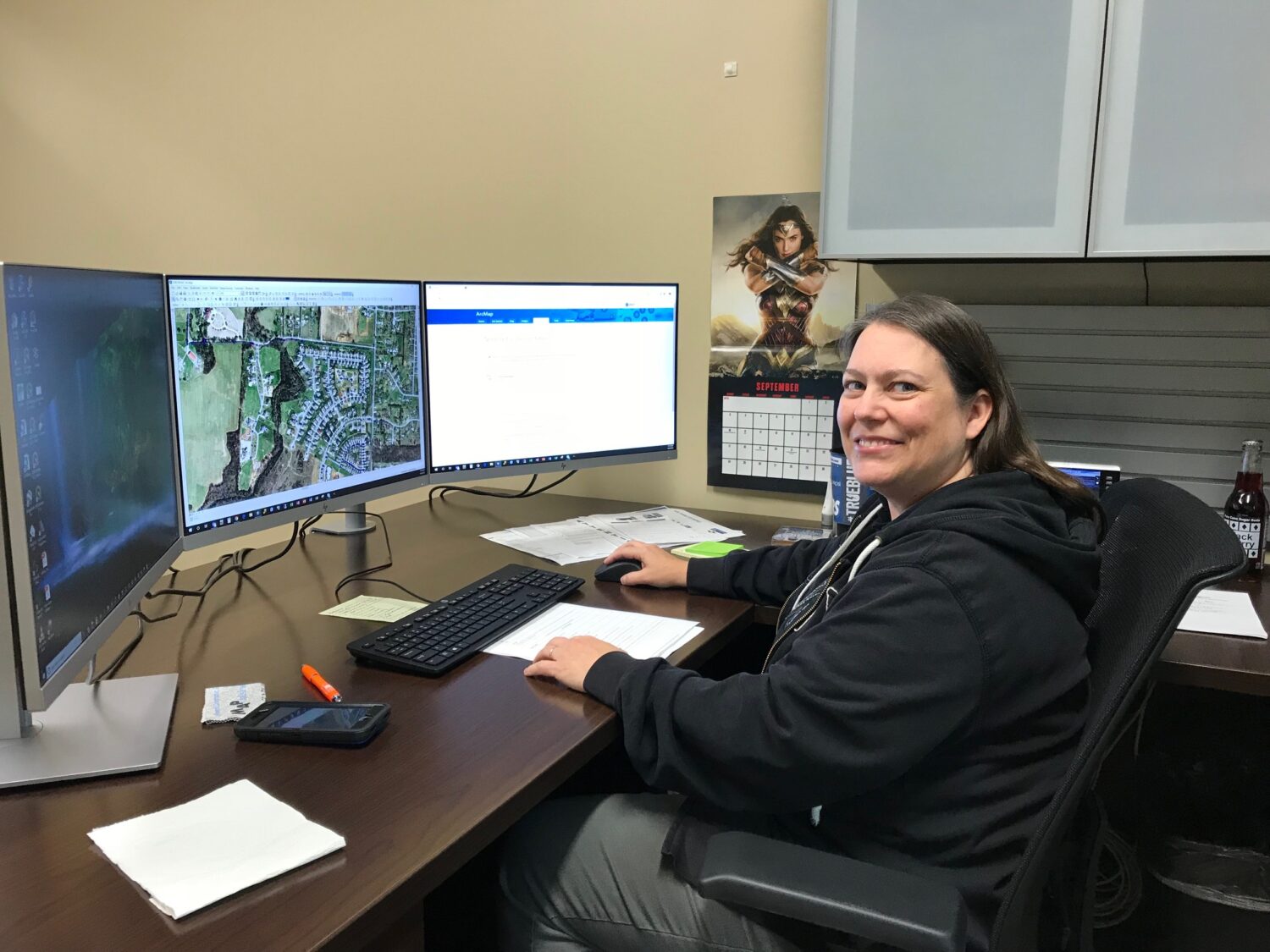
Bethany Hall serves as the Geographic Information Systems (GIS) Coordinator with Consolidated Utility District (CUD) of Rutherford County, using her capabilities in data collection and geography as well as her knowledge as an FAA-certified drone pilot. That skillset also feeds her fascination with 20th century battlefields, especially in the Pacific islands and Asia.
With CUD’s blessing, Bethany will take a leave of absence from May 2021 to January 2022 to work with the Department of POW/MIA Accounting Agency (DPAA) on locating battlefields and the remains of U.S servicemen fallen in battle. Bethany will be stationed at Joint Base Pearl Harbor-Hickam on Oahu, HI.
How did you become interested in GIS? And how does that work with your love of history?
“My journey into GIS began by accident. My dad was an electrician and a plumber, and as a kid I read the blueprints and would help him install wiring or plumbing. As for my education, I attended ITT tech in Nashville and earned an Associates of Applied Science and Computer Aided Drafting Design and Technology. I also attended American InterContinental University and earned my bachelor’s degree in Information Technology.”
“In 2008, I enrolled at MTSU in the Public History program as a master’s degree student. I started doing training and research on battlefields and GIS. I have a fascination with 20th century warfare, and I completed a study abroad in 2009 with MTSU to the island of Peleliu, a state in Palau, which is part of the Federated States of Micronesia. It takes 36 hours to get there via plane.”
Before we get into your project with the Department of Defense, help us understand your work with CUD. Name something that would directly impact our ratepayers.
“I manage our GIS data, and we have a ton of data collected from the field crews and inspectors. We analyze that, edit the data, and quality control it. This takes us from data collectors to data driven decision makers.”
“One of the reasons we do this is to help serve fire protection needs in our community. So, that’s something the ratepayers would probably see above ground since most of our tangible assets are below ground. We did a study recently using CUD’s GIS data and fire calls for service from Rutherford County and the City of Murfreesboro to see where we can improve fire protection services in our community.”
Let’s talk about your master’s degree. What in particular were you working on?
“My work is like an extension of the master’s program I completed at MTSU. I completed a capstone project from the field data I produced from data on a study abroad to Vietnam. I wanted to tie the data into in a living, breathing web map or a story map to help people understand how many men from MTSU who were killed during the Vietnam War.”
“There were 16 men from MTSU who died from combat in Vietnam. Some of the servicemen had only attended MTSU maybe a semester or two before they were drafted or enlisted. Several of them were graduates of the ROTC program and went into the Army Helicopter Corps. They were infantry officers, enlisted, or helicopter pilots. In fact, several of the fallen MTSU Blue Raiders were shot down on search and recovery missions or flying fire support missions for men on the ground.”
You’ve done really important work to help families understand what happened to their lost loved ones. You have an extended leave of absence coming up from CUD. Tell us about that.
“My work involves the Department of POW/MIA Accounting Agency (DPAA), which is a division of the Department of Defense. I’ve received funding through ORISE (Oak Ridge Institute of Science and Education), and I’ll be doing a mentorship program with the DPAA. I’ll be helping archeologists, historians, and forensic scientists with the data they have collected about MIA cases in Asia.”
“My experience in Vietnam is going to come in handy. They said that’s one of the reasons why they selected me to be a participant. I sent them my capstone project, and they asked if I’d be willing to do something to help families gain some closure. A lot of these servicemembers have been missing for decades. These families don’t know where their son was killed or where he’s buried or anything.”
“After 9/11, I asked my grandmother some questions about World War II, because she remembers Pearl Harbor when it happened. She was in her early 20s and married to a serviceman at the time. At the time of Pearl Harbor, both of her brothers were barely 17 or 18. They went to enlist in the armed forces. My Uncle John enlisted in the Marine Corps with five of his friends from Plymouth, Michigan. So, in the spring of 1942, they were all going to boot camp in San Diego.”
“After boot camp, they all kind of got split up with different jobs in the Marine Corps. But what really started me down this road was when I had to do a report on World War II when I was a kid. I asked my grandparents about it. My grandfather grabbed my shirt collar and said, “You never speak of World War II to your grandmother. It’s too painful.””
Certainly, that moment would have stuck with you in a powerful way. Knowing that your family had a real history with World War II …
“So, I was like, OK, something happened. After my grandfather passed away – and my grandmother was still living after 9/11 – I asked again, because I had a child of my own now, and we had all these questions. She said, “I want you to find out what my brother did in the war. He never came home.”
“My grandmother suffered a stroke and was near the end of her life. I made an emergency records request with the National Records Administration because the rate of loss of World War II veterans is so high. We’re losing almost 2,000 veterans a day now. The agency fast-tracked it.”
“My grandmother passed away two weeks before we received the records packet. When I opened it up, there was her brother, John’s, service record. I reached out to several veterans’ groups, and it turns out he served in his first battle at Peleliu, one of the most intense, physical battles of the Pacific. U.S. forces encountered heavily fortified Japanese forces underground. He was a machine gunner, and his job was to clear out the caves.”
“It was terribly dangerous work, and he was wounded. The life of a machine gunner in World War II was very short-lived. John carried the Browning automatic rifle, and he survived Peleliu. Even before Peleliu, he had fought in the Cape Gloucester-New Britain campaign that led up to the big island battles of Peleliu, Iwo Jima, and then Okinawa.”
“From there, John was killed during one of the big pushes to take Shuri Castle and some landmarks on Okinawa. It was nasty, dirty business. On Okinawa, Operation Iceberg was a huge undertaking, and it was the doorstep of the Japanese homeland.”
“When the telegram came to the house explaining that my Uncle John had been killed in Okinawa, my great-grandmother locked herself in a room for three days and did not come out to eat or drink. She emerged white headed from grief. My family never spoke of it.”
“It’s very meaningful, knowing that my ancestors stood on the battlegrounds of the Pacific. John’s name is now on a monument in Plymouth, Michigan, honoring World War II dead. I’m still trying to learn more, so four years ago I reached out to one of his friends who just celebrated his 94th birthday. But because of his health problems and COVID, I can’t visit him. I feel like I have unfinished business.”
Earlier you mentioned ORISE, the DoD, and DPAA. How are they supporting you with this work?
“To get permission and assistance, I worked through ORISE. They partner with Department of Defense agencies. They supply the funding through the Department of Energy for researchers and mentors to complete projects.”
“I’m being loaned out as a visiting scholar. The research is based on historical records and facts, and they rely on archeologists and forensic scientists along with geographers to help locate potential recovery sites. The DPAA office in Hawaii is the agency that handles everything from the Asian campaigns, whether it’s World War II, Korea, or Vietnam. They’re heavily focused on World War II remains right now because the number of living vets is dwindling. So, there’s a small window of time left to do this work.”
“My project will be to help them create a GIS portal to bring together all the historical information, the geographical, the archeological, and the forensic science. We’ll put it in a GIS portal for the recovery teams to have maps on their mobile devices in the field. The field collection teams are made up of military volunteers with different skillsets like medics, doctors, engineers, etc.”
In terms of research, this sounds like something you’re almost building a template for.
“I’ve been asked if I can write a paper about the process. Hopefully, that work will get peer reviewed and published. It would be the first paper that I’ve had published solely as the initial creator.”
“I’ve notified my former MTSU professors and department chair as I had to step down as an adjunct professor at MTSU because everything has been up in the air because of COVID and funding issues. Finally, I was awarded the project, and the funding started on December 1st of 2020. But because of COVID, I couldn’t travel to Hawaii to complete it. I now can go to Hawaii, and I’ll be on island the first week of May.”
“When I come back to CUD, I’ll take the DPAA experience and transfer that into the classroom at MTSU and into CUD’s GIS Portal. I’ve talked several times with the Geosciences Department and the Human Geography Department to develop a spatial humanities course that would put my love of history and geography together with a GIS component.”
When you’ve completed this, is there a part that can help CUD?
“We’re planning to create a GIS hub that’s organized with maps and apps for every department from Customer Service, Engineering, Water Quality, Maintenance, Operations, Safety, etc. We’re also going to set up a public-facing GIS hub for developers and contractors to submit plots, plans, and other materials. We’re really hoping to cross the final threshold from data collectors to decision makers. It would be a big step for CUD to have a GIS hub for all the different public and internal business uses.”
Related Articles

Why Cybersecurity at CUD Is a Full-Time Job
Cyberattacks are unfortunately part of our new normal. For public utilities, the work involved with building and maintaining strong online defenses is an everyday effort because essential services present an

Scan this code with your phone’s camera to view our 2020 Water Quality Report
This year, we’re doing something different. Yes, the annual Water Quality Report will still arrive in June and July billing statements. However, CUD wants to transform what is typically a